
 Wet conditions delayed widespread harvest across Iowa during the week ending Oct. 5, according to the USDA, National Agricultural Statistics Service. There were 3.3 days suitable for fieldwork statewide, and only 2.4 days in west central Iowa. Activities for the week included harvesting hay and the start of fall tillage. Farmers were hoping for drier field and crop conditions to enable substantial harvest to begin.
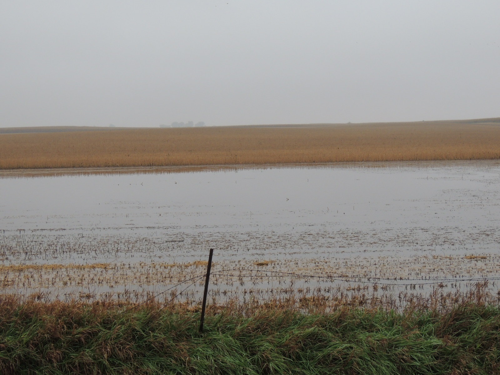
Topsoil moisture statewide rated 4 percent short, 80 percent adequate, and 16 percent surplus. In west central Iowa ratings were 76 percent short and 24 percent surplus.
Subsoil moisture levels statewide rated 1 percent very short, 7 percent short, 80 percent adequate, and 12 percent surplus. Southwest Iowa was the wettest with almost half of its topsoil in surplus condition. West central Iowa was rated as 83 percent adequate and 16 percent surplus.
With almost all of Iowa’s corn acreage in or beyond the dent stage, corn mature reached 79 percent, six days behind the five-year average. Moisture content of all corn in the field, at 27 percent, continued to delay harvest. Only 5 percent of corn has been harvested so far, three weeks behind the normal pace. In west central Iowa, 87 percent of the corn is mature but only 2 percent has been harvested. Seventy-six percent of the corn crop was reported in good to excellent condition.
With almost all of the soybean acreage turning color, 85 percent of the crop was dropping leaves or beyond, just behind average. West central Iowa soybeans are ahead of the state, with 100 percent turning color and 86 percent dropping leaves. Soybean harvest was 9 percent complete statewide, the lowest percentage harvested by this date in over 30 years. The shortage of days for field work shows on the harvest rate; only 5 percent of the soybeans were harvested in west central Iowa as of Oct. 5. Seventy-four percent of the soybean crop was in good to excellent condition.
The third cutting of alfalfa hay was 95 percent complete, almost 2 weeks behind the five-year average.
Iowa preliminary weather summary by Harry Hillaker, state climatologist, Iowa Department of Agriculture & Land Stewardship: The week began with unseasonably warm weather with daytime highs mostly in the eighties on Sunday (Sept. 28). Temperatures slowly cooled, but remained above normal, through Thursday (Oc. 2). Well below normal temperatures prevailed over the weekend. A freeze was recorded over most of northwest Iowa on Saturday morning, roughly north of Interstate 80 and west of Interstate 35. A hard freeze was recorded in a few areas with Sibley and Holstein recording lows of 28 degrees early Saturday. Another freeze impacted northeastern Iowa on Sunday morning, roughly northeast of a Mason City to Cedar Rapids line. Once again a few areas recorded a hard freeze with Elkader and Stanley recording 28 degree lows early Sunday.
Temperatures for the week as a whole averaged 1.1 degrees above normal. Volunteer weather observer John Beltz reported a high temperature of 82 degrees on Sept. 27 and a low temperature of 53 degrees on Sept. 30 and Oct. 1.
Rain was widespread from Tuesday (Sept. 30) afternoon through Wednesday morning with heavy rain over portions of southwest Iowa. Light to moderate rain fell over much of Iowa on Thursday. Finally, snow flurries and/or very light rain fell across northern Iowa Friday evening into Saturday morning.